
Upper Mount Gravatt QLD Suburb Profile 2026: Land Values, Rent, Schools and Lifestyle

By Tim AllenBuyer’s Agent and Director, IPS Buyer’s Agents
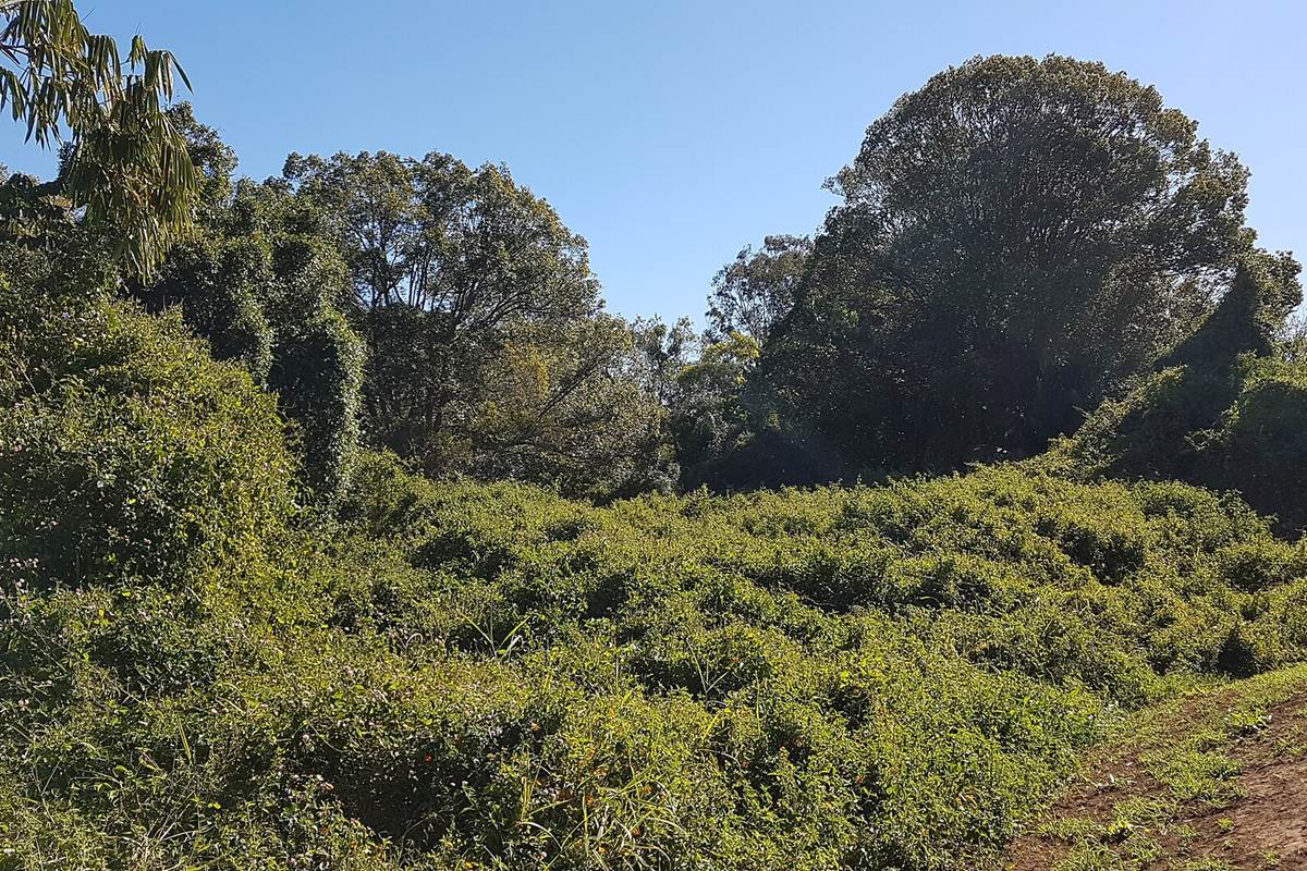
Bush along Mimosa Creek near the Hibiscus sports centre, 2018. Photo: Orderinchaos, CC BY-SA 4.0, via Wikimedia Commons.
Upper Mount Gravatt (postcode 4122) is a southern Brisbane suburb about 13 km from the CBD by road, home to 10,800 people at the 2021 Census and to Westfield Mt Gravatt, with the Upper Mount Gravatt busway station beneath it. Its state school opened in 1929, and the Pacific Motorway and the South East Busway run along its western edge. At the Queensland Valuer-General’s 2025 valuation the median value of residential land was $710,000, up 20.3% in two years, and homes were renting for $625 a week in September 2026.
Checked 20 November 2026. Every figure names its source, and the full list is under References at the end. Prices come from the Queensland Valuer-General’s land valuations, which the Queensland Government publishes for anyone to use.
Upper Mount Gravatt at a glance
| Upper Mount Gravatt, QLD 4122 | Figure | Source |
|---|---|---|
| Council | Brisbane City Council | Queensland Government |
| Distance to Brisbane CBD | About 13 km by road; 12 to 16 min drive off-peak, 20 to 45 min leaving at 7.30am | Google Maps, Nov 2026 |
| Population | 10,800 people, median age 33 | ABS Census 2021 |
| Median value of residential land | $710,000 at 1 October 2024, up 20.3% in two years (2,706 properties) | Queensland Valuer-General, 2025 valuation |
| Against Brisbane | Brisbane-wide median $720,000, up 16.1% | Queensland Valuer-General, 2025 valuation |
| Median rent, all homes | $625 a week (3-bed house $700, 4-bed $800, 2-bed unit $700) | RTA, Sep quarter 2026 |
| Rent since 2017 | All homes up from $360 to $625 a week (+74%) | RTA, September quarters |
| Homes rented | 44% (Queensland 33%) | ABS Census 2021 |
| Homes | 58% separate houses, 34% units and apartments | ABS Census 2021 |
| State school catchments | Mostly Upper Mount Gravatt State School; MacGregor State High | Queensland Government, Jul 2026 |
| Public transport | Upper Mount Gravatt busway station; bus 186 about 36 min to the CBD | Google Maps, Nov 2026 |
| Nearest hub | Upper Mount Gravatt itself: one of Brisbane’s four principal regional activity centres | SEQ Regional Plan 2009–2031 |
| Biggest plan | Upper Mt Gravatt Centre precinct plan, for more homes near the centre: approval expected mid 2027 | Brisbane City Council |
| Reported offences | 2,826 in 12 months: about 262 per 1,000 residents (Brisbane: 90) | QPS Online Crime Map, Nov 2026 |
| Next land valuation | Brisbane is not in the 2027 program | Queensland Valuer-General |
Is Upper Mount Gravatt a good place to live?
Upper Mount Gravatt suits people who want everything close: a big shopping centre, the busway, Griffith University’s Nathan and Mt Gravatt campuses next door and a 12 to 16 minute drive to the CBD outside peak hour, at a land value about the same as Brisbane’s median. The trade-offs are the traffic on Logan Road and Kessels Road, a crime count driven by the shopping centre, and more units than most of Brisbane’s middle ring. At the 2021 Census 58% of homes were separate houses and 34% were units or apartments (Queensland: 13%), 44% were rented and the median age was 33.
It is really three places in one, and each comes with its own checks.
| Part of Upper Mount Gravatt | What you get | What to check |
|---|---|---|
| Around the centre | Units and apartments near Westfield Mt Gravatt, the busway and Logan Road | The body corporate records, the noise, and the precinct plan for the sites around you |
| The streets east of Logan Road | Post-war and 1960s houses on standard blocks, many rebuilt or extended | The building report, the school catchment and the slope of the block |
| Near Mimosa Creek and the Outlook | Houses near the creek parks and the Mt Gravatt bushland | The flood map along Mimosa Creek and bushfire mapping on the slopes |
What is the median house price in Upper Mount Gravatt?
We use only free, open government data in this profile, and that has no current median sale price for Upper Mount Gravatt. The official open measure is the Queensland Valuer-General’s median value of residential land: $710,000 at 1 October 2024, up 20.3% from $590,000 two years earlier, across 2,706 properties. That is about the same as Brisbane’s median of $720,000, which rose 16.1%.
Median value of residential land (Queensland Valuer-General, 2025 valuation):
| Area | Median at 1 Oct 2022 | Median at 1 Oct 2024 | Change | Properties |
|---|---|---|---|---|
| Upper Mount Gravatt | $590,000 | $710,000 | +20.3% | 2,706 |
| Mount Gravatt | $630,000 | $700,000 | +11.1% | 953 |
| Mount Gravatt East | $640,000 | $770,000 | +20.3% | 3,467 |
| Wishart | $660,000 | $790,000 | +19.7% | 2,952 |
| Macgregor | $650,000 | $830,000 | +27.7% | 1,781 |
| Mansfield | $670,000 | $870,000 | +29.9% | 2,903 |
| Eight Mile Plains | $650,000 | $880,000 | +35.4% | 3,581 |
| All of Brisbane | – | $720,000 | +16.1% | – |
A land valuation is the Valuer-General’s estimate of what the land alone was worth on the valuation date, without the house. It is not a sale price, and these figures are now two years old: Brisbane was last valued at 1 October 2024. It is not in the 2027 program, so these are the newest official figures; councils use them to set rates and the state uses them for land tax. A third of Upper Mount Gravatt’s homes are units, which share their land, so the land figure says little about what a unit costs. For what homes have actually sold for, compare recent sales on the property portals, or ask us.
The median rent on new leases for all homes in Upper Mount Gravatt was $625 a week in the September quarter 2026, up from $590 a year earlier and $360 in September 2017, according to the Residential Tenancies Authority’s bond data: a 74% rise in nine years.
| September quarter | All homes, Upper Mount Gravatt (median weekly rent) |
|---|---|
| 2017 | $360 |
| 2019 | $390 |
| 2021 | $360 |
| 2022 | $480 |
| 2023 | $530 |
| 2024 | $580 |
| 2025 | $590 |
| 2026 | $625 |
By type in the September quarter 2026: three-bedroom houses $700 a week, four-bedroom houses $800, two-bedroom units $700 and three-bedroom units $780 (RTA).
Who rents. At the 2021 Census 44% of Upper Mount Gravatt’s homes were rented, against 33% across Queensland; 27% were being paid off and 25% were owned outright (Queensland: 34% and 29%).
Most of Upper Mount Gravatt is in the Upper Mount Gravatt State School catchment, going by the Queensland Government’s July 2026 maps, with the rest in Wishart State School’s. For high school, most of it is in MacGregor State High School’s catchment, with smaller parts in Mansfield and Mount Gravatt state high schools’.
| State school | Share of Upper Mount Gravatt in its catchment | Enrolment management plan |
|---|---|---|
| Upper Mount Gravatt State School | 73% | No |
| Wishart State School | 27% | Yes |
| MacGregor State High School | 71% | Yes |
| Mansfield State High School | 19% | Yes |
| Mount Gravatt State High School | 11% | Yes |
The shares are of the locality’s mapped area, not homes, so put the exact address into the Queensland Government’s EdMap before you rely on a catchment. Wishart State School and all three high schools enforce their catchments under enrolment management plans, so they take children from outside only when they have room; you prove the address with a current lease, a rates notice or an unconditional contract, plus a utility bill. Upper Mount Gravatt State School was not on the Department of Education’s list of schools with plans when we checked. The suburb also has St Bernard’s, a Catholic primary school founded in 1953.
Upper Mount Gravatt is about 13 km south-east of the Brisbane CBD by road. Driving to King George Square takes about 12 to 16 minutes outside peak hour and 20 to 45 minutes leaving at 7.30am on a weekday. On a weekday morning, bus 186 takes about 36 minutes door to door, and the busway station under Westfield Mt Gravatt has buses and the Metro to the city.
| From Upper Mount Gravatt to | How | Typical time |
|---|---|---|
| Brisbane CBD (King George Square) | Car, leaving 7.30am weekday (13.2 km) | 20 to 45 min |
| Brisbane CBD | Car, off-peak | 12 to 16 min |
| Brisbane CBD | Bus 186, leaving 7.33am | 36 min door to door |
| Westfield Mt Gravatt | Car, off-peak | 3 min |
| Princess Alexandra Hospital | Car, off-peak | 12 min |
| Brisbane Airport | Car, off-peak | 18 to 22 min |
| Gold Coast (Surfers Paradise) | Car, off-peak | 45 to 55 min |
| Sunshine Coast (Mooloolaba Beach) | Car, off-peak | 1 hr 15 min to 1 hr 30 min |
On Census day 2021, 57% of Upper Mount Gravatt’s workers drove or rode in a car to work, 10% took public transport (Queensland: 4%) and 16% worked from home (Queensland: 14%).
Upper Mount Gravatt is a hub in its own right. The South East Queensland Regional Plan 2009–2031 named it one of Brisbane’s four principal regional activity centres, with Chermside, Indooroopilly and Carindale, the level below the CBD. Westfield Mt Gravatt and the busway station are in the suburb, the Princess Alexandra Hospital is 12 minutes away and Griffith University’s Nathan and Mt Gravatt campuses are next door.
Brisbane grows mostly by infill, and the council has picked the Upper Mt Gravatt centre as one of the places for it. The 2017 ShapingSEQ background paper on growth set Brisbane a benchmark of 188,200 more homes between 2016 and 2041, 176,800 of them in existing urban areas, and the council’s precinct plan for the centre (below) is meant to allow more of them here.
The biggest change coming to Upper Mount Gravatt is a plan, not a building site: Brisbane City Council’s Upper Mt Gravatt Centre Suburban Renewal Precinct plan, which will change the planning rules for the Upper Mt Gravatt Centre and Logan Road precincts.
- What it aims to do: increase housing choice close to services, jobs and businesses; connect homes and businesses with the Upper Mt Gravatt busway station, the Metro and the V1 Veloway along the Pacific Motorway; encourage landscaping, shade and buildings suited to the climate; and keep a mix of business, retail, community and personal services.
- Where it is up to: the draft plan was out for comment from 21 August to 20 September 2026. The council expects to prepare the final plan between late 2026 and early 2027, with council and Queensland Government approval and adoption into City Plan in mid 2027. Its page gives no building heights or dwelling numbers.
- Who decides: Brisbane City Council writes the plan, and the Queensland Government has to approve it before it becomes part of City Plan.
What it means if you buy in Upper Mount Gravatt: more apartments and mixed-use buildings are likely to be allowed near Westfield Mt Gravatt, the busway and Logan Road once the plan is adopted. If you are buying near the centre, read the draft maps for the sites around you, because what can be built next door changes the view, the noise and the parking.
Westfield Mt Gravatt, Griffith University and the Princess Alexandra Hospital are the big employers near Upper Mount Gravatt, and the CBD is 12 to 16 minutes away off-peak. Professionals were the biggest group of its workers at the 2021 Census.
- Jobs (2021 Census): professionals 29.1% (Queensland 21.4%), clerical and administrative workers 11.8%, technicians and trades workers 11.6%, community and personal service workers 11.6% and managers 10.1%.
- Top industries: hospitals 4.7%, cafes and restaurants 3.9%, supermarkets 2.7%, takeaway food 2.7% and higher education 2.3%.
- Work patterns: 62.3% of adults were in the labour force (Queensland 61.6%), 7.1% were unemployed (Queensland 5.4%) and the median household income was $1,657 a week.
Upper Mount Gravatt’s reported crime rate is far above Brisbane’s, and the shopping centre is a big part of the reason. It recorded 2,826 offences on the Queensland Police Service’s online crime map in the 12 months to 18 November 2026, about 262 for every 1,000 residents, against 90 per 1,000 across Brisbane. “Other theft”, the group that includes shoplifting, was more than half the total, at 1,473.
| Offence type | Upper Mount Gravatt, 12 months to 18 Nov 2026 |
|---|---|
| Other theft (not break-ins) | 1473 |
| Drug offences | 321 |
| Good order offences | 264 |
| Traffic and related offences | 175 |
| Other | 154 |
| Trespassing and vagrancy | 118 |
| Property damage | 97 |
| Unlawful entry (break-ins) | 79 |
| Assault | 73 |
| Fraud | 72 |
Police say the map’s figures are not official statistics and its locations show a general area; the rates use 2021 Census populations, and a suburb with one of Brisbane’s biggest shopping centres counts offences by people who do not live there. There were 79 break-ins in the year, about 7 per 1,000 residents. Before you buy, look up your own street on the map.
Upper Mount Gravatt is about the shopping centre and the green spaces around it: Mimosa Creek, the parks off Logan Road and the Mt Gravatt Outlook bushland next door. Ratings are Google’s, checked 19 November 2026.
Parks and the bush
- Mount Gravatt Outlook Reserve, next door on Shire Road: 4.6 stars from 1,149 reviews.
- Abbeville Street Park: 4.3 from 182 reviews.
- Dittmer Park, Logan Road: 4.1 from 195 reviews.
Food and coffee
- Cenzo’s Cafe + Bar, Lumley Street: 4.6 from 622 reviews.
- Ya Hoo Dining, Malaysian food on Logan Road: 4.5 from 616 reviews.
- Dhamaka Restaurant & Bar, Palmdale Shopping Centre: 4.5 from 814 reviews.
For kids
- Mount Gravatt Park playground, Klumpp Road: 4.8 from 18 reviews.
- Brush Box Park, Lumley Street: 4.4 from 38 reviews.
For adults
- Southern Cross Sports Club, on the corner of Klumpp and Logan roads: 4.3 from 782 reviews.
- Club Southside, Mount Gravatt–Capalaba Road: 4.2 from 2,100 reviews.
The local pub
The Newnham Hotel, 516 Newnham Road: a pub with event spaces, rated 4.3 from 973 Google reviews, and our pick for a meal or a drink in the suburb.
Check the precinct plan, the flood map and the body corporate before you talk price in Upper Mount Gravatt. These are the things that change a price here.
- The precinct plan. Read the council’s draft maps for the Upper Mt Gravatt Centre and Logan Road precincts: what may be built next door matters more here than in most suburbs.
- Flood. Streets near Mimosa Creek may be flood-prone. Get Brisbane City Council’s free FloodWise property report for the address.
- Units. For a unit, read the body corporate records: the sinking fund, special levies and any building defects.
- Noise. Homes near Logan Road, Kessels Road, the M3 and the busway hear it. Visit at peak hour.
- The school address. The south-east of the suburb is in Wishart State School’s catchment, and Wishart enforces it. Check the exact address on EdMap.
IPS Buyer’s Agents works only for buyers, and we have bought in Upper Mount Gravatt, including a first home won at auction in September 2023; you can also read a client’s review of buying here with us. In Upper Mount Gravatt, Zian and I check the precinct plan, the flood map and the building report before we talk price.
Comparing Upper Mount Gravatt with Mount Gravatt East, Wishart or Holland Park? Book a free call and tell us your brief. See how we work as a Brisbane buyer’s agent, our Holland Park and Tarragindi profiles and our other Brisbane suburb reports.
Is Upper Mount Gravatt in Brisbane?
Yes. Upper Mount Gravatt is a southern suburb in Brisbane City Council, about 13 km from the CBD by road, between Mount Gravatt and Eight Mile Plains. Westfield Mt Gravatt, the shopping centre once called Garden City, and the Upper Mount Gravatt busway station are in the suburb.
What is the land value in Upper Mount Gravatt?
The Queensland Valuer-General put the median value of residential land in Upper Mount Gravatt at $710,000 at 1 October 2024, up 20.3% in two years and about the same as Brisbane’s $720,000. Brisbane is not in the 2027 valuation program.
How much is rent in Upper Mount Gravatt?
About $625 a week for all homes on new leases in the September quarter 2026: $700 for a three-bedroom house, $800 for a four-bedroom house and $700 for a two-bedroom unit (Residential Tenancies Authority). Rents for all homes are up 74% since 2017.
Which school catchment is Upper Mount Gravatt in?
Most of it is in the Upper Mount Gravatt State School catchment for primary, with the south-east in Wishart State School’s, and most of it is in MacGregor State High School’s catchment. Wishart and the high schools enforce their catchments. Check the exact address on EdMap.
How far is Upper Mount Gravatt from Brisbane?
About 13 km by road: 12 to 16 minutes by car to the CBD outside peak hour, and 20 to 45 minutes leaving at 7.30am. Bus 186 takes about 36 minutes door to door. Brisbane Airport is 18 to 22 minutes away and Surfers Paradise 45 to 55.
Is Upper Mount Gravatt safe?
Its reported crime rate is far above Brisbane’s, mostly because of the shopping centre: 2,826 offences on the police crime map in the 12 months to 18 November 2026, about 262 per 1,000 residents against 90. Thefts such as shoplifting were more than half, at 1,473; there were 79 break-ins.
What is being built in Upper Mount Gravatt?
Brisbane City Council is writing a precinct plan for the Upper Mt Gravatt centre and Logan Road to allow more homes near the shopping centre, the busway and the Metro. The draft was out for comment from 21 August to 20 September 2026, and the council expects approval and adoption into City Plan in mid 2027.
Who lives in Upper Mount Gravatt?
A young, mixed crowd: at the 2021 Census the median age was 33, 44% of homes were rented (Queensland: 33%), a third were units and apartments, and 46% of residents had both parents born overseas (Queensland: 28%). Professionals were the biggest group of workers.
- Queensland Valuer-General: Land valuation update 2025, Brisbane (median value of residential land, valuation date 1 October 2024), from the past valuation overviews
- Queensland Valuer-General: land valuations in 2027
- Residential Tenancies Authority: median rents by suburb, September quarter 2026
- Australian Bureau of Statistics: 2021 Census QuickStats, Upper Mount Gravatt
- Queensland Government: state school catchments, July 2026
- Department of Education: school enrolment management plans
- Queensland Police Service: Online Crime Map, 19 November 2025 to 18 November 2026
- Queensland Government: South East Queensland Regional Plan 2009–2031, Part C (Brisbane)
- Queensland Government: ShapingSEQ 2017, Background paper 1: Grow, Table 9 (dwelling supply benchmarks to 2041)
- Brisbane City Council: Upper Mt Gravatt Centre Suburban Renewal Precinct (draft out for comment 21 August to 20 September 2026)
- Brisbane City Council: FloodWise property reports
- Wikipedia: Upper Mount Gravatt, Queensland
- Google Maps: drive times and ratings, checked 19 November 2026