
Buderim QLD Suburb Profile 2026: House Prices, Rent, Schools and Lifestyle

By Tim AllenBuyer’s Agent and Director, IPS Buyer’s Agents
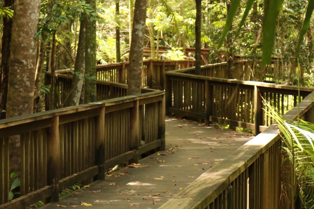
Buderim Forest Park boardwalk, March 2016. Photo: HollyS0, CC BY-SA 4.0, via Wikimedia Commons.
Buderim (postcode 4556) is a leafy hilltop town on the Sunshine Coast, home to about 31,000 people in Sunshine Coast Council, about 92 km north of the Brisbane CBD by road, above Maroochydore and Mooloolaba with coast views from its escarpment. Homes range from units and older houses near the Burnett Street village to large family houses on the slopes, and Mooloolaba Beach is 14 minutes away. In October 2026 the median house value was about $1.44 million, four-bedroom houses were renting for $1,100 a week, and the rental vacancy rate for the 4556 postcode was 0.82%.
Checked 16 November 2026. Every figure names its source, and the full list is under References at the end.
Buderim at a glance
| Buderim, QLD 4556 | Figure | Source |
|---|---|---|
| Council | Sunshine Coast Council | Queensland Government |
| Distance to Brisbane CBD | About 92 km by road; 1 hr 5 min to 1 hr 20 min drive off-peak, 1 hr 20 min to 2 hr 10 min leaving at 7.30am | Google Maps, Nov 2026 |
| Population | 31,430 people, median age 46 | ABS Census 2021 |
| Median house value | $1,440,583 | Cotality, Oct 2026 |
| Median price, 4-bedroom house | $1,450,000 (249 sales, 30 days on market) | Domain, 12 months to Nov 2026 |
| House value growth | +5.8% over 12 months, +38.8% over 5 years, +111.8% since Oct 2017 | Cotality, Oct 2026 |
| Median rent, 4-bedroom house | $1,100 a week, up 12% in a year | RTA, Sep quarter 2026 |
| Gross rental yield | Houses 3.6%, units and townhouses 4.2% | Cotality, Oct 2026 |
| Rental vacancy rate (postcode 4556) | 0.82% | SQM Research, Oct 2026 |
| Homes | 73% separate houses, 16% townhouses and semi-detached, 11% units | ABS Census 2021 |
| State school catchments | Mostly Buderim Mountain State School; Chancellor State College, Maroochydore or Mountain Creek State High | Queensland Government, Jul 2026 |
| Public transport | Buses; no train station | Translink |
| Nearest regional hub | Maroochydore (principal regional activity centre), 12 min | SEQ Regional Plan 2009–2031 |
| Biggest build nearby | Maroochydore City Centre, including the $300 million SOL by Walker towers | Sunshine Coast Council, 2026 |
| Reported offences | 456 in 12 months: about 15 per 1,000 residents (Sunshine Coast: 50) | QPS Online Crime Map, Nov 2026 |
Is Buderim a good place to live?
Buderim suits families and downsizers who want a large house, high-scoring primary schools and the beach, the airport and the university hospital each within about 15 minutes. The trade-offs are the price, hills that make some blocks hard to build on or maintain, and slow public transport to Brisbane. At the 2021 Census, 73% of homes were separate houses, 37% were owned outright (Queensland: 29%), 46% of families were couples without children at home, the median age was 46 and the median household income was $1,729 a week (Queensland: $1,675).
It is really three suburbs in one, and each comes with its own checks.
| Part of Buderim | What you get | What to check |
|---|---|---|
| The escarpment, on the coastal side | Views over Maroochydore and Mooloolaba to the sea | The slope, retaining walls, drainage and the landslide overlay |
| The plateau and village, around Burnett Street | Flatter established streets near the shops, the school and the forest park | The age and condition of the house, and traffic near the village |
| The lower slopes and newer estates, towards the motorway | Newer family houses closer to the Sunshine Motorway and Sippy Downs | Road noise, drainage in the low spots, and the estate’s covenants |
What is the median house price in Buderim?
Buderim’s median house value was $1,440,583 at the end of October 2026, 5.8% higher than a year earlier, according to Cotality, while three- and four-bedroom houses sold for medians of $1.17 million and $1.45 million over the past year (Domain), up from $871,750 and $1.11 million in 2022. Units and townhouses had a median value of $837,834, and two- and three-bedroom units sold for medians of $735,000 and $888,000.
Market trends by bedrooms (sales in the 12 months to November 2026, Domain):
| Home | Median price | Average days on market | Auction clearance | Sold in 12 months | 2022 median |
|---|---|---|---|---|---|
| 3-bedroom house | $1,170,000 | 21 | 58% | 175 | $871,750 |
| 4-bedroom house | $1,450,000 | 30 | 45% | 249 | $1,110,000 |
| 5-bedroom house | $1,760,000 | 36 | 35% | 84 | $1,330,000 |
| 2-bedroom unit | $735,000 | 16 | – | 64 | $504,000 |
| 3-bedroom unit | $888,000 | 19 | – | 65 | $640,000 |
Growth over 12 months, 5, 9 and 17 years:
| Period | Houses | Units and townhouses | Source |
|---|---|---|---|
| 12 months to Oct 2026 | +5.8% | +6.2% | Cotality, median value |
| 5 years to Oct 2026 | +38.8% (6.8% a year) | +53.7% (9.0% a year) | Cotality, median value |
| 9 years, Oct 2017 to Oct 2026 | +111.8% (8.7% a year) | +115.0% (8.9% a year) | Cotality, median value |
| 17 years, May 2009 to Nov 2026 (postcode 4556) | $569,000 to $1,510,027, +165% (5.7% a year) | $380,000 to $797,462, +110% (4.3% a year) | SQM Research, asking prices |
The 17-year row covers the whole 4556 postcode, which includes Sippy Downs, Mons and Tanawha. A 20- or 30-year sales median needs paid sales data such as Pricefinder.
A four-bedroom house in Buderim rents for about $1,100 a week: that was the median on new leases in the September quarter 2026, up from $980 a year earlier and $550 in September 2017, according to the Residential Tenancies Authority’s bond data. Rents for these houses have doubled in nine years.
| September quarter | 4-bedroom house, Buderim (median weekly rent) |
|---|---|
| 2017 | $550 |
| 2019 | $565 |
| 2021 | $750 |
| 2022 | $780 |
| 2023 | $800 |
| 2024 | $890 |
| 2025 | $980 |
| 2026 | $1,100 |
In the same quarter three-bedroom houses rented for $850 a week, up from $480 in 2017, and two-bedroom units for $615, up from $345 (RTA).
Rental yield and vacancy. Cotality puts Buderim’s gross yield at 3.6% for houses and 4.2% for units and townhouses. A four-bedroom house at the $1.45 million median, rented at $1,100 a week, yields 3.9% before costs. SQM Research counted a vacancy rate of 0.82% for the 4556 postcode in October 2026, well under the 2.6% to 3.5% the REIQ treats as a healthy market.
Most of Buderim is in the Buderim Mountain State School catchment, going by the Queensland Government’s July 2026 maps, with the edges split between five other primary schools. For high school it is split three ways, between Chancellor State College, Maroochydore State High and Mountain Creek State High.
| State school | Share of Buderim’s land in its catchment | 2025 score (Better Education) | Enrolment management plan |
|---|---|---|---|
| Buderim Mountain State School | 55% | 96 | Yes |
| Mountain Creek State School | 14% | 85 | Yes |
| Kuluin State School | 13% | – | Yes |
| Chancellor State College (primary) | 6% | 91 | Yes |
| Mooloolaba State School | 6% | 95 | Yes |
| Maroochydore State School | 5% | 77 | No |
| Chancellor State College (secondary) | 50% | 88 | Yes |
| Maroochydore State High School | 31% | 86 | Yes |
| Mountain Creek State High School | 19% | 83 | Yes |
The shares are of land area, not homes, so put the exact address into the Queensland Government’s EdMap before you rely on a catchment. All of these schools except Maroochydore State School enforce their catchments under enrolment management plans, so they take children from outside only when they have room; you prove the address with a current lease, a rates notice or an unconditional contract, plus a utility bill. Better Education publishes no score for Kuluin State School. The scores are Better Education’s, a third party’s ranking built on NAPLAN results.
Buderim is about 92 km north of the Brisbane CBD by road. Driving to King George Square takes 1 hour 5 minutes to 1 hour 20 minutes outside peak hour and 1 hour 20 minutes to 2 hours 10 minutes leaving at 7.30am on a weekday, and public transport, two buses and a train, takes about 2 hours 19 minutes, according to Google Maps.
| From Buderim to | How | Typical time |
|---|---|---|
| Brisbane CBD (King George Square) | Car, leaving 7.30am weekday (101 km via the M1) | 1 hr 20 min to 2 hr 10 min |
| Brisbane CBD | Car, off-peak | 1 hr 5 min to 1 hr 20 min |
| Brisbane CBD | Buses 616 and 615 from Ballinger Road, then the train, leaving 7.45am weekday | 2 hr 19 min |
| Sunshine Plaza, Maroochydore | Car, off-peak | 12 min |
| Sunshine Coast University Hospital | Car, off-peak | 16 min |
| Sunshine Coast Airport | Car, off-peak | 14 min |
| Sunshine Coast (Mooloolaba Beach) | Car, off-peak | 14 min |
| Brisbane Airport | Car, off-peak | 1 hr to 1 hr 5 min |
| Gold Coast (Surfers Paradise) | Car, off-peak | 1 hr 50 min to 2 hr 10 min |
On Census day 2021, 67% of workers drove or were driven to work, 1% took public transport and 17% worked from home.
Maroochydore, 12 minutes away, is Buderim’s hub. The South East Queensland Regional Plan 2009–2031 named it the Sunshine Coast’s only principal regional activity centre and the focus for the coast’s infill growth, and named Sippy Downs, next door, one of its major regional activity centres, with the University of the Sunshine Coast.
The Sunshine Coast is one of the region’s main growth areas. The 2017 ShapingSEQ background paper on growth set it a benchmark of 87,000 more homes between 2016 and 2041, 53,700 of them in existing urban areas and 33,300 in new estates.
The biggest build near Buderim is the Maroochydore City Centre, the Sunshine Coast’s new CBD, 12 minutes away, where offices, a private hospital, apartments and a data centre have gone up or are under construction.
- Why: to give the Sunshine Coast a city centre of its own, in the place the 2009 plan named as the coast’s principal centre.
- What is being built: construction is under way on the $300 million SOL by Walker, with 251 apartments in two 19-storey towers, and on NEXTDC’s $200 million SC2 data centre. The $100 million, 10-storey Maroochy Private Hospital has been built, and the 15-storey 50 First Avenue, with about 12,000 m² of offices and Unitywater as its anchor tenant, has its structure finished.
- Who: private developers, including Walker Corporation and NEXTDC, in a city centre led by Sunshine Coast Council.
- Where it is up to: the council’s March 2026 update had the hospital due to open in the first half of 2026 and SC2 under construction; its 2026 investment outlook has SOL under construction. Neither gives a completion date for SOL.
What it means if you buy in Buderim: more jobs, offices and services 12 minutes from home. If you are buying a unit to rent out, watch the new apartments coming in Maroochydore, which will compete for the same tenants.
Maroochydore’s new city centre and Sunshine Plaza, 12 minutes away, and the Sunshine Coast University Hospital at Birtinya, 16 minutes, are the biggest job centres within reach, with the University of the Sunshine Coast next door at Sippy Downs and the Kunda Park and Forest Glen business and industrial areas to the north.
- Jobs (2021 Census): professionals 26.9%, managers 13.2%, community and personal service workers 13.0%, technicians and trades workers 12.8%.
- Top industries: hospitals 6.0%, cafés and restaurants 3.0%, social assistance 2.9%, aged care 2.8% and primary schools 2.6%.
- Work patterns: 59.0% of adults were in the labour force and 3.9% were unemployed (Queensland 5.4%).
Buderim’s reported crime rate is less than a third of the Sunshine Coast’s. It recorded 456 offences on the Queensland Police Service’s online crime map in the 12 months to 15 November 2026, about 15 for every 1,000 residents, against 50 per 1,000 across the Sunshine Coast Council area (17,074 offences). Theft is the biggest group, and break-ins were about one in ten offences.
| Offence type | Buderim, 12 months to 15 Nov 2026 |
|---|---|
| Other theft (not break-ins) | 129 |
| Traffic and related offences | 68 |
| Property damage | 54 |
| Unlawful entry (break-ins) | 49 |
| Drug offences | 38 |
| Other | 27 |
| Assault | 26 |
| Fraud | 20 |
| Good order offences | 19 |
| Other offences against the person | 15 |
| Unlawful use of a motor vehicle | 11 |
Police say the map’s figures are not official statistics and its locations show a general area; the rates use 2021 Census populations. Before you buy, look up your own street on the map and check where the offences cluster.
The forest park’s boardwalk and waterfall, the Burnett Street village and the views are Buderim’s own, with Mooloolaba Beach 14 minutes away. Ratings are Google’s, checked 16 November 2026.
Parks and bushland
- Buderim Forest Park, with its rainforest boardwalk and waterfall: 4.7 stars from 1,768 reviews.
- Buderim Village Park, Church Street: 4.7 from 446 reviews.
- Eric Joseph Foote War Memorial Sanctuary: 4.7 from 201 reviews.
- Lions Park, Burnett Street: 4.5 from 168 reviews.
Food and coffee
- Dee Den Restaurant, Burnett Street: 4.8 from 2,336 reviews.
- John Kyle Espresso, Main Street: 4.8 from 458 reviews.
- Somewhere On Buderim, Vietnamese, Burnett Street: 4.7 from 380 reviews.
- Hamptons Espresso, Goshawk Boulevard: 4.7 from 352 reviews.
- Cafe 65, Burnett Street: 4.5 from 545 reviews.
For kids
- Amaze World, Tanawha Tourist Drive, Tanawha: 4.4 from 1,436 reviews.
- Wirreanda Park, Short Street: 4.4 from 176 reviews.
- Rush Adventureland, Plaza Parade, Maroochydore: 4.2 from 248 reviews.
For adults
- Your Mates Brewing Co., Technology Drive, Warana: 4.7 from 1,198 reviews.
- 10 Toes Brewery, Pittards Road, Buderim: 4.5 from 109 reviews.
- Buderim Distilling Co, Ocean Street, Maroochydore: 4.9 from 189 reviews.
The local pub
The Buderim Tavern, 81 Burnett Street, in the village: rated 4.4 from 4,657 Google reviews, and our pick for a meal or a drink in Buderim.
Check the slope, the water and the school address before you talk price in Buderim. On the hill, the view is free but the slope isn’t.
- Slope and landslide. Sunshine Coast Council’s planning scheme maps landslide hazard and steep land. On a sloping block, have the retaining walls and drainage inspected, and check that walls and decks were approved.
- Where the water runs. Look at the block in heavy rain if you can, and check the council’s flood mapping for homes on the lower slopes and near creeks.
- Older homes. The QBCC says most homes built before 1990 contain some asbestos, so for an older home book building, pest and asbestos checks before you sign.
- The school address. Buderim Mountain’s catchment covers most of the suburb but not all of it. Check the exact address in EdMap, since these schools take children from outside only when they have room.
IPS Buyer’s Agents works only for buyers and has bought on the Sunshine Coast for clients, including at Mount Coolum, Bli Bli and next door in Sippy Downs: read the Sippy Downs success story on University Way. On Buderim’s hill, Zian and I check the slope, the retaining walls and where the water runs before we talk price.
Comparing Buderim with Sippy Downs, Mountain Creek or Mooloolaba? Book a free call and tell us your brief. See how we work as a Sunshine Coast buyer’s agent, our guides to the Sunshine Coast property market and the best suburbs on the Sunshine Coast, and our other Sunshine Coast suburb reports.
Is Buderim in Sunshine Coast Council?
Yes. Buderim is in Sunshine Coast Council, on a hill between Maroochydore, Mooloolaba and Sippy Downs, about 92 km north of the Brisbane CBD by road, so its rates, planning and flood maps come from Sunshine Coast Council.
What is Buderim’s postcode?
4556, which it shares with Sippy Downs, Mons and Tanawha, among others. Postcode figures, such as SQM Research’s vacancy rate and asking prices, cover all of them.
How far is Buderim from the beach?
About 14 minutes by car to Mooloolaba Beach (8.0 km) outside peak times, according to Google Maps.
Does Buderim have a train station?
No. Buses link Buderim to the coast and the train line. The quickest public transport trip to Brisbane leaving at 7.45am, two buses and a train, took 2 hours 19 minutes on Google Maps.
How many people live in Buderim?
About 31,000. The 2021 Census counted 31,430 people with a median age of 46, and 37% of homes were owned outright (Queensland: 29%).
Is Buderim hilly?
Yes. Buderim sits on a hill, with a steep escarpment on its coastal side and gentler land on the plateau, so slope, retaining walls and drainage matter on many blocks. Sunshine Coast Council’s planning scheme maps landslide hazard and steep land.
How far is Buderim from Sunshine Coast Airport?
About 14 minutes by car (12.2 km) outside peak times, and 16 minutes to Sunshine Coast University Hospital at Birtinya, according to Google Maps.
How many homes sell in Buderim each year?
Around 650. Cotality counted 653 sales in the 12 months to October 2026, and four-bedroom houses sold in about 30 days on Domain’s figures.
- Cotality via OnTheHouse: Buderim suburb profile (median values, growth, rents, yields), as at 31 October 2026
- Domain: Buderim suburb profile, market trends by bedrooms, checked 16 November 2026
- Residential Tenancies Authority: median rents by suburb, September quarter 2026
- SQM Research: vacancy rates and asking prices for postcode 4556
- Australian Bureau of Statistics: 2021 Census QuickStats, Buderim
- Queensland Government: state school catchments, July 2026
- Department of Education: school enrolment management plans
- Better Education: 2025 school scores
- Queensland Police Service: Online Crime Map, 16 November 2025 to 15 November 2026
- Queensland Government: South East Queensland Regional Plan 2009–2031, Part C (Sunshine Coast)
- Queensland Government: ShapingSEQ 2017, Background paper 1: Grow, Table 9 (dwelling supply benchmarks to 2041)
- Invest Sunshine Coast (Sunshine Coast Council): CBD milestones signal maturity, 26 March 2026
- Invest Sunshine Coast (Sunshine Coast Council): a bold future ahead, 2026
- Wikipedia: Buderim, Queensland
- Google Maps: drive and transit times and ratings, checked 16 November 2026