
Redland Bay QLD Suburb Profile 2026: House Prices, Rent, Schools and Lifestyle

By Tim AllenBuyer’s Agent and Director, IPS Buyer’s Agents
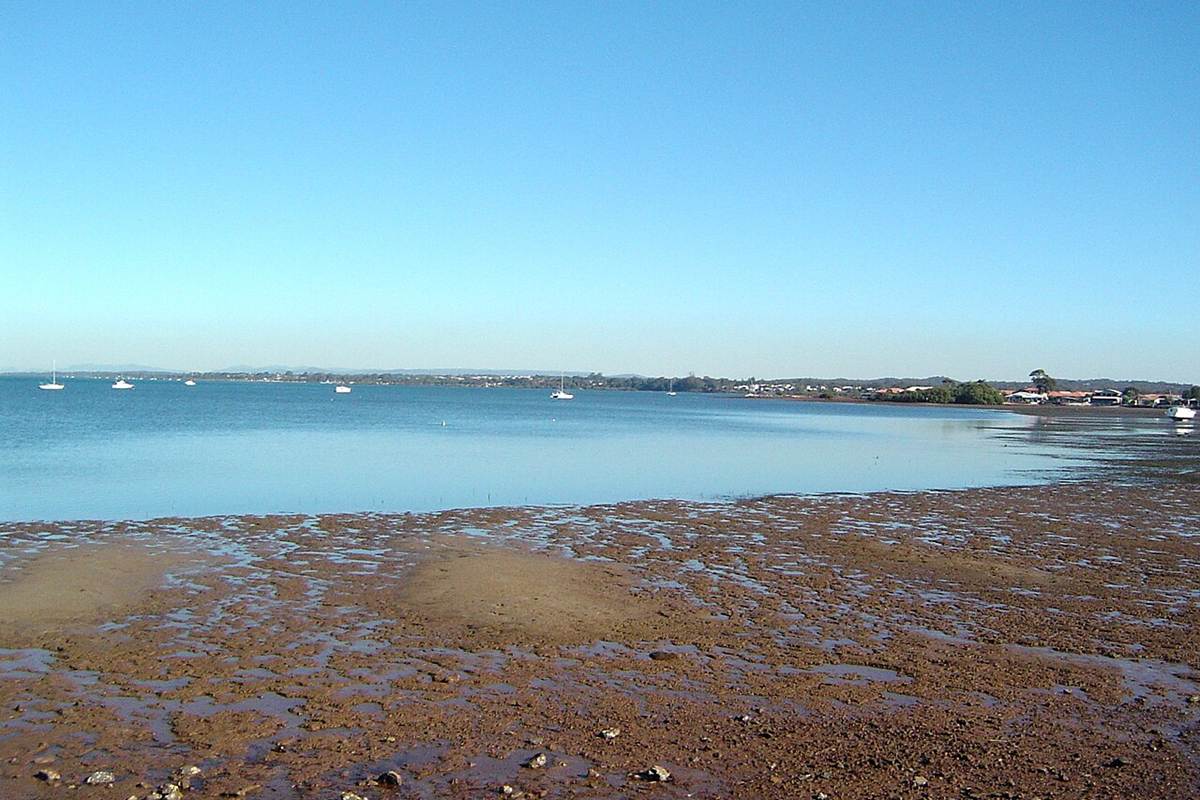
Redland Bay viewed from Victoria Point, June 2014. Photo: Shiftchange, CC0, via Wikimedia Commons.
Redland Bay (postcode 4165) is the Redlands’ southern mainland suburb, on the bay facing the southern Moreton Bay islands, home to about 17,100 people about 45 km south-east of the Brisbane CBD by road. Older streets run down to the water and the island ferries at Weinam Creek, and Stockland’s Shoreline community is filling the south with new family homes. In October 2026 the median house value was about $1.15 million, four-bedroom houses were renting for $800 a week, and the rental vacancy rate for the 4165 postcode was 1.45%.
Checked 16 November 2026. Every figure names its source, and the full list is under References at the end.
Redland Bay at a glance
| Redland Bay, QLD 4165 | Figure | Source |
|---|---|---|
| Council | Redland City Council | Queensland Government |
| Distance to Brisbane CBD | About 45 km by road; 45 min drive off-peak, 1 hr to 1 hr 40 min leaving at 7.30am | Google Maps, Nov 2026 |
| Population | 17,056 people, median age 40 | ABS Census 2021 |
| Median house value | $1,148,373 | Cotality, Oct 2026 |
| Median price, 4-bedroom house | $1,170,000 (152 sales, 21 days on market) | Domain, 12 months to Nov 2026 |
| House value growth | +2.7% over 12 months, +55.8% over 5 years, +110.6% since Oct 2017 | Cotality, Oct 2026 |
| Median rent, 4-bedroom house | $800 a week, up 4% in a year | RTA, Sep quarter 2026 |
| Gross rental yield | Houses 3.5% | Cotality, Oct 2026 |
| Rental vacancy rate (postcode 4165) | 1.45% | SQM Research, Oct 2026 |
| Homes | 94% separate houses, 68% with four or more bedrooms | ABS Census 2021 |
| State school catchments | Redland Bay or Scenic Shores State School for most of the suburb; Victoria Point State High | Queensland Government, Jul 2026 |
| Public transport | Buses; ferries to the islands from Weinam Creek; trains from Cleveland, 22 min by car | Translink; Google Maps |
| Nearest regional hub | Cleveland (principal regional activity centre), 22 min | SEQ Regional Plan 2009–2031 |
| Biggest build nearby | Stockland’s Shoreline: about 3,000 homes planned, more than 700 delivered, in the suburb | Redland Bayside News, Apr 2026 |
| Reported offences | 755 in 12 months: about 44 per 1,000 residents (Redland: 51) | QPS Online Crime Map, Nov 2026 |
Is Redland Bay a good place to live?
Redland Bay suits families who want a big house near the water, new schools and parks, and a bayside village, within an hour of the city. The trade-offs are a long drive or a bus and train to Brisbane, storm tide checks near the bay, koala habitat rules near the bush, and years of construction in the south of the suburb. At the 2021 Census, 94% of homes were separate houses, 68% had four or more bedrooms (Queensland: 39%), 45% were being paid off with a mortgage, 23% were rented, 84% of households were families, the median age was 40, and the median household income was $2,046 a week (Queensland: $1,675).
It is really three suburbs in one, and each comes with its own checks.
| Part of Redland Bay | What you get | What to check |
|---|---|---|
| The old village by the water, around Broadwater Terrace and Weinam Creek | Older houses near the foreshore parks, the pub and the island ferries | Storm tide mapping, the Weinam Creek plans and the building report |
| The established estates | Larger family homes on bigger blocks | The koala map near the bush, the building report and the school address |
| Shoreline and the new south | New homes and house-and-land in Stockland’s community, near Scenic Shores State School | Covenants, the builder, what will be released next door, and storm tide near the foreshore |
What is the median house price in Redland Bay?
Redland Bay’s median house value was $1,148,373 at the end of October 2026, 2.7% higher than a year earlier, according to Cotality, and three- and four-bedroom houses sold for medians of $1.005 million and $1.17 million over the past year (Domain), up from $831,000 and $1.02 million in 2025 and $697,000 and $820,000 in 2022. Almost every sale is a house: Cotality counted 314 house sales and 17 unit sales in the 12 months to August 2026.
Market trends by bedrooms (sales in the 12 months to November 2026, Domain):
| Home | Median price | Average days on market | Auction clearance | Sold in 12 months | 2022 median |
|---|---|---|---|---|---|
| 3-bedroom house | $1,005,000 | 27 | – | 73 | $697,000 |
| 4-bedroom house | $1,170,000 | 21 | – | 152 | $820,000 |
| 5-bedroom house | $1,350,000 | 24 | – | 62 | $997,000 |
| 3-bedroom unit | $1,115,000 | 54 | – | 16 | $920,000 |
Growth over 12 months, 5, 9 and 17 years:
| Period | Houses | Source |
|---|---|---|
| 12 months to Oct 2026 | +2.7% | Cotality, median value |
| 5 years to Oct 2026 | +55.8% (9.3% a year) | Cotality, median value |
| 9 years, Oct 2017 to Oct 2026 | +110.6% (8.6% a year) | Cotality, median value |
| 17 years, May 2009 to Nov 2026 (postcode 4165) | $522,500 to $1,143,490, +119% (4.6% a year) | SQM Research, asking prices |
Cotality’s modelled house value rose 2.7% in the year, but the houses that sold rose more: Cotality’s own 12-month median sale price went from $1 million to $1.2 million, and Domain’s three-bedroom median rose 21%. Cotality models every house in the suburb, while sale medians move with whatever sold that year, including Shoreline’s new homes, so look at both. A 20- or 30-year sales median needs paid sales data such as Pricefinder.
A four-bedroom house in Redland Bay rents for about $800 a week: that was the median on new leases in the September quarter 2026, up from $770 a year earlier and $470 in September 2017, according to the Residential Tenancies Authority’s bond data. That is a 70% rise in nine years.
| September quarter | 4-bedroom house, Redland Bay (median weekly rent) |
|---|---|
| 2017 | $470 |
| 2019 | $460 |
| 2021 | $540 |
| 2022 | $600 |
| 2023 | $650 |
| 2024 | $700 |
| 2025 | $770 |
| 2026 | $800 |
In the same quarter three-bedroom houses rented for $680 a week, up from $640 a year earlier and $420 in 2017, and all homes together for $800 (RTA).
Rental yield and vacancy. Cotality puts Redland Bay’s gross yield for houses at 3.5%. A four-bedroom house at the $1.17 million median, rented at $800 a week, yields 3.6% before costs; a three-bedroom house at $1.005 million and $680 a week yields 3.5%. SQM Research counted a vacancy rate of 1.45% for the 4165 postcode in October 2026, up from 1.01% a year earlier and still under the 2.6% to 3.5% the REIQ treats as a healthy market.
Redland Bay’s land is split almost evenly between the Redland Bay and Scenic Shores state school catchments, going by the Queensland Government’s July 2026 maps, with small edges in four others, and nine-tenths of it is in the Victoria Point State High catchment. The shares below leave out the bay water inside the suburb’s boundary, about a tenth of it.
| State school | Share of Redland Bay’s land in its catchment | 2025 score (Better Education) | Enrolment management plan |
|---|---|---|---|
| Redland Bay State School | 45% | 83 | Yes |
| Scenic Shores State School | 44% | 79 | Yes |
| Mount Cotton State School | 4% | 92 | Yes |
| Woongoolba State School | 3% | 82 | Yes |
| Carbrook State School | 3% | 79 | No |
| Victoria Point State High School | 91% | 77 | Yes |
| Shailer Park State High School | 8% | 83 | Yes |
The shares are of land area, not homes, so put the exact address into the Queensland Government’s EdMap before you rely on a catchment. Most of these schools enforce their catchments under enrolment management plans, so they take children from outside only when they have room; you prove the address with a current lease, a rates notice or an unconditional contract, plus a utility bill. Carbrook State School was not on the Department of Education’s list of schools with plans when we checked. Calvary Christian College at Carbrook (94) and St Rita’s at Victoria Point (89) are among the private schools nearby. The scores are Better Education’s, a third party’s ranking built on NAPLAN results.
Redland Bay is about 45 km south-east of the Brisbane CBD by road. Driving to King George Square takes about 45 minutes outside peak hour and 1 hour to 1 hour 40 minutes leaving at 7.30am on a weekday, and the bus takes about 2 hours, according to Google Maps.
| From Redland Bay to | How | Typical time |
|---|---|---|
| Brisbane CBD (King George Square) | Car, leaving 7.30am weekday (45.4 km via the M1 and M3) | 1 hr to 1 hr 40 min |
| Brisbane CBD | Car, off-peak | 45 min |
| Brisbane CBD | Bus 282 from German Church Road, then the 555 busway bus | 1 hr 58 min |
| Weinam Creek ferry terminal | Car, off-peak | 12 min |
| Victoria Point Shopping Centre | Car, off-peak | 12 min |
| Redland Hospital | Car, off-peak | 20 min |
| Cleveland station | Car, off-peak | 22 min |
| Brisbane Airport | Car, off-peak | 45 min |
| Gold Coast (Surfers Paradise) | Car, off-peak | 55 min |
| Sunshine Coast (Mooloolaba Beach) | Car, off-peak | 1 hr 40 min to 1 hr 50 min |
Times are from the middle of the suburb, near German Church Road. On Census day 2021, 70% of workers drove or rode in a car to work, 2% took public transport and 14% worked from home.
Cleveland is Redland Bay’s closest regional hub, 22 minutes away. The South East Queensland Regional Plan 2009–2031 named Cleveland and Capalaba the Redlands’ two principal regional activity centres, the level below the Brisbane CBD; Cleveland has the council, Redland Hospital and the train, and Victoria Point, 12 minutes away, has the nearest big shopping centre.
The 2017 ShapingSEQ background paper on growth set Redland City a benchmark of 17,200 more homes between 2016 and 2041, 12,500 of them in existing urban areas. Shoreline is one of the biggest areas of new homes in the Redlands.
The biggest build in Redland Bay is Stockland’s Shoreline community in the south of the suburb, planned for about 3,000 homes.
- What it adds: new streets of family homes with 2.8 km of foreshore parkland and more than a quarter of the land kept as green space, and Scenic Shores State School inside the community.
- Who: Stockland, the developer.
- Where it is up to: Stockland says it has delivered more than 700 homes, with almost a quarter of the planned 3,000 completed or under construction, and it released the first lots of its Bay Hill precinct, 294 lots to come in stages, in April 2026.
- Also in the suburb: at Weinam Creek, the ferry terminal’s priority development area, Redland City Council voted in February 2026 to hand land to the Queensland Government for a multi-storey car park, and the state began compulsory acquisition of land near the terminal in April 2026. No construction date has been published.
What it means if you buy in Redland Bay: more neighbours, schools and parks in the south over the next decade, and more new homes competing with resales. If you are buying near Shoreline’s edges, ask what will be built next door and when; near Weinam Creek, ask what the car park and terminal plans mean for traffic and parking.
Cleveland, Victoria Point and Capalaba are Redland Bay’s nearest job centres, with Redland Hospital 20 minutes away and the Brisbane CBD 45 minutes away outside peak hour.
- Jobs (2021 Census): technicians and trades workers 17.0%, professionals 16.0%, clerical and administrative workers 15.6%, managers 13.4%, community and personal service workers 11.3%.
- Top industries: hospitals 3.8%, primary schools 3.1%, supermarkets 3.0%, aged care 2.4% and takeaway food 2.0%.
- Work patterns: 65.0% of adults were in the labour force (Queensland 61.6%) and 4.2% were unemployed (Queensland 5.4%).
Redland Bay’s reported crime rate is a little below the Redlands’ as a whole. It recorded 755 offences on the Queensland Police Service’s online crime map in the 12 months to 15 November 2026, about 44 for every 1,000 residents, against 51 per 1,000 across Redland City (8,167 offences). “Other theft”, the group that includes shoplifting, and drug offences were the largest groups.
| Offence type | Redland Bay, 12 months to 15 Nov 2026 |
|---|---|
| Other theft (not break-ins) | 180 |
| Drug offences | 176 |
| Traffic and related offences | 109 |
| Property damage | 54 |
| Unlawful use of a motor vehicle | 46 |
| Other | 45 |
| Assault | 44 |
| Unlawful entry (break-ins) | 38 |
| Good order offences | 34 |
| Fraud | 29 |
Police say the map’s figures are not official statistics and its locations show a general area; the rates use 2021 Census populations, and drug offences are often recorded where police find them. Break-ins numbered 38 in the year. Before you buy, look up your own street on the map.
The foreshore parks, the bushland of Bayview Conservation Park and the island ferries are Redland Bay’s own, with Victoria Point’s shops and restaurants 12 minutes away. Ratings are Google’s, checked 16 November 2026.
Parks and the bay
- Bayview Conservation Park, Days Road: 4.8 stars from 167 reviews.
- Sel Outridge Park, Hamilton Street: 4.4 from 323 reviews.
- Point Talburpin Park, McWilliam Street: 4.4 from 79 reviews.
- Jingeri Park, Shoreline Avenue, with a lighthouse play tower: 4.4 from 34 reviews.
Food and coffee
- Vee’s Burger Café, Broadwater Terrace: 4.9 from 186 reviews.
- dhc coffee co, Jardine Drive: 4.9 from 69 reviews.
- Nikan Cafè, Donald Road: 4.8 from 87 reviews.
- The Park Social, Jardine Drive: 4.7 from 236 reviews.
- Merak GF Artisan Deli Cafe, Broadwater Terrace: 4.5 from 398 reviews.
For kids
- Jingeri Park and its lighthouse: 4.4 from 34 reviews.
- Sel Outridge Park on the foreshore: 4.4 from 323 reviews.
- Point Talburpin Park: 4.4 from 79 reviews.
- Bayview Conservation Park trails: 4.8 from 167 reviews.
For adults
- Elysium Restaurant & Bar, Victoria Point: 4.6 from 1,227 reviews.
- Victoria Point Tavern, Victoria Point: 4.6 from 2,748 reviews.
- Pelican Cafe, the Esplanade: 4.3 from 708 reviews.
The local pub
The Redland Bay Hotel, 160 Broadwater Terrace: a historic pub on the water with a beer garden and a kids’ playground, rated 4.2 from 2,956 Google reviews, and our pick for a meal or a drink by the bay.
Check the storm tide map, the koala map and what is planned next door before you talk price in Redland Bay. The location is easy to like, and these are the things that change a price.
- Storm tide and flood. The Flood and Storm Tide Hazard Overlay is part of the Redland City Plan, and its 2100 storm tide area assumes 0.8 m of sea-level rise. A property enquiry through the council gives the levels for the lot; price the insurance before you sign.
- Koalas. Koala habitat mapping can limit clearing and building on a lot near bushland, such as around Bayview Conservation Park. Check the council’s and the state’s koala maps before you plan a pool or an extension.
- What is next door. In and around Shoreline, ask what is approved and when it will be built, and read the estate covenants on fences, colours, sheds and parking.
- The builder. For a new home, search the builder’s QBCC licence, check the Queensland Home Warranty Scheme cover, and get an independent inspection before handover.
- Older homes. The QBCC warns that many homes built before 1990 may contain asbestos. Book building, pest and asbestos checks for an older house near the village.
IPS Buyer’s Agents knows the Redlands first-hand. My first 12 years were in Alexandra Hills and the next 13 in Capalaba. Knowing an area doesn’t change how we buy: in Redland Bay, Zian and I check the storm tide map, the koala map and what is planned next door before we talk price.
Comparing Redland Bay with Victoria Point, Thornlands or Cleveland? Book a free call and tell us your brief. See how we work as a Redlands buyer’s agent, our guide to the Redlands property market and our other Redlands suburb reports.
Is Redland Bay in Redland City?
Yes. Redland Bay is the Redlands’ southern mainland suburb, on the bay about 45 km south-east of the Brisbane CBD by road, so its rates, planning and storm tide maps come from Redland City Council. The southern Moreton Bay islands it faces are separate suburbs.
What is Redland Bay’s postcode?
4165, which it shares with Victoria Point and Mount Cotton. SQM Research’s vacancy rate and asking prices for 4165 cover all three.
What is Shoreline in Redland Bay?
Stockland’s master-planned community in the south of the suburb. Stockland says it has delivered more than 700 homes there, with almost a quarter of a planned 3,000 completed or under construction, and it released the first lots in its 294-lot Bay Hill precinct in April 2026.
Where do the island ferries leave from?
Weinam Creek, at Redland Bay Marina, about 12 minutes by car from the middle of the suburb. Ferries and the vehicle barge run from there to the southern Moreton Bay islands.
Is there a train to Redland Bay?
No. The nearest station is Cleveland, the end of the Cleveland line, about 22 minutes away by car. Buses link Redland Bay with Victoria Point, Cleveland and Loganholme.
How many people live in Redland Bay?
About 17,100. The 2021 Census counted 17,056 people with a median age of 40, and 84% of households were families (Queensland: 71%).
Is Redland Bay a safe suburb?
Its reported crime rate is below the Redlands’ average: 755 offences in the year to 15 November 2026, about 44 per 1,000 residents, against 51 per 1,000 across Redland City.
How many homes sell in Redland Bay each year?
About 330. Cotality counted 314 house sales and 17 unit sales in the 12 months to August 2026, and four-bedroom houses sold in about 21 days on Domain’s figures.
- Cotality via OnTheHouse: Redland Bay suburb profile (median values, growth, rents, yields, sales), as at 31 October 2026
- Domain: Redland Bay suburb profile, market trends by bedrooms, checked 16 November 2026
- Residential Tenancies Authority: median rents by suburb, September quarter 2026
- SQM Research: vacancy rates and asking prices for postcode 4165
- Australian Bureau of Statistics: 2021 Census QuickStats, Redland Bay
- Queensland Government: state school catchments, July 2026
- Department of Education: school enrolment management plans
- Better Education: 2025 school scores
- Queensland Police Service: Online Crime Map, 16 November 2025 to 15 November 2026
- Queensland Government: South East Queensland Regional Plan 2009–2031, Part C (Redland)
- Queensland Government: ShapingSEQ 2017, Background paper 1: Grow, Table 9 (dwelling supply benchmarks to 2041)
- Redland Bayside News: Shoreline’s Bay Hill precinct, 15 April 2026
- Redland City Council: Weinam Creek Priority Development Area project
- Redlands Coast Today: new multi-storey car park at Weinam Creek, February 2026
- Redland City Council: storm tide mapping information
- QBCC: homeowners urged to investigate before they renovate, 19 November 2023
- Wikipedia: Redland Bay, Queensland
- Google Maps: drive and transit times and ratings, checked 16 November 2026