
Browns Plains QLD Suburb Profile 2026: House Prices, Rent, Schools and Lifestyle

By Tim AllenBuyer’s Agent and Director, IPS Buyer’s Agents
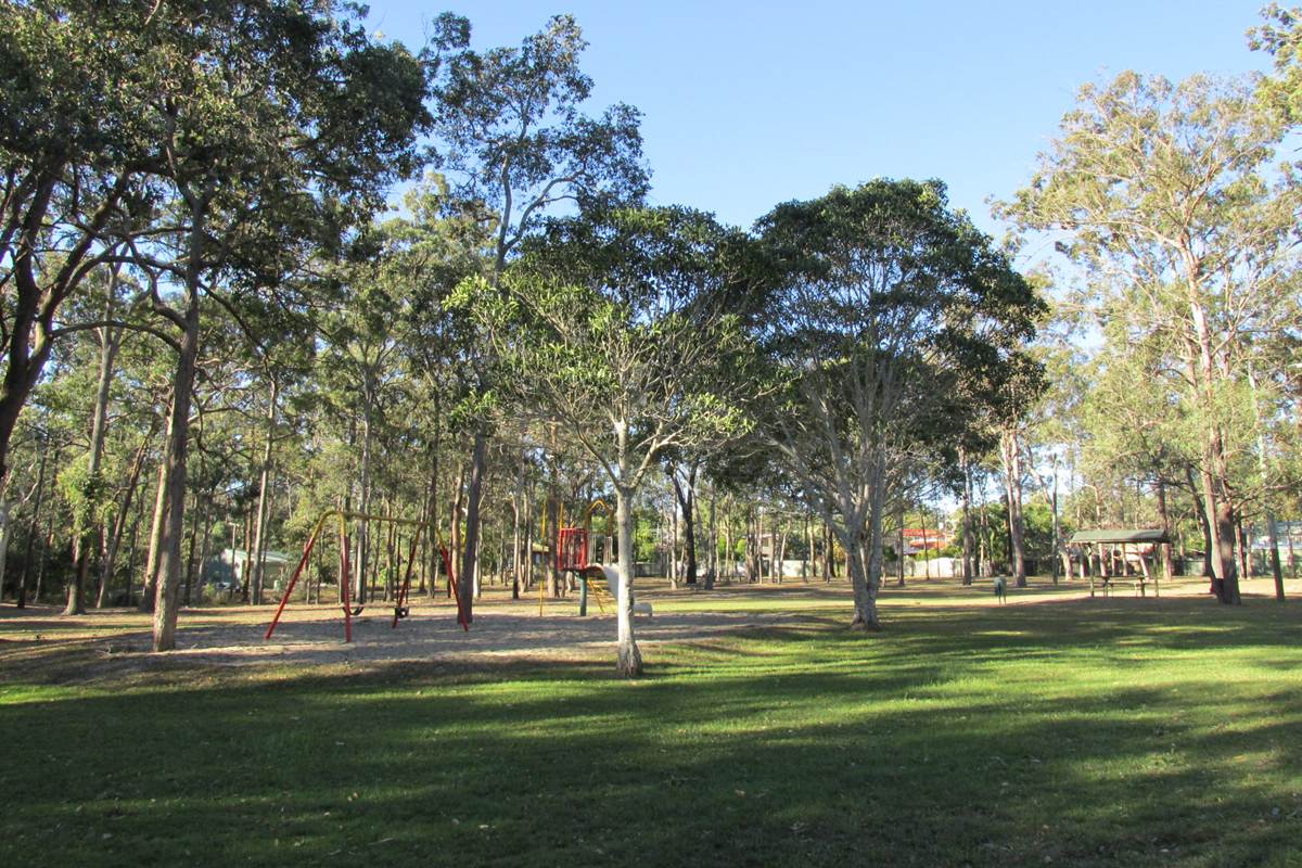
Acacia Park, Browns Plains, July 2014. Photo: Orderinchaos, CC BY-SA 3.0, via Wikimedia Commons.
Browns Plains (postcode 4118) is a shopping and service centre on Logan’s western side, home to about 6,600 people in the City of Logan, about 30 km south of the Brisbane CBD by road, around the Grand Plaza shopping centre and the Mount Lindesay Highway. Most homes are three-bedroom houses, with townhouses near the centre. In October 2026 the median house value was about $887,000, three-bedroom houses were renting for $610 a week, and the rental vacancy rate for the 4118 postcode was 0.95%.
Checked 16 November 2026. Every figure names its source, and the full list is under References at the end.
Browns Plains at a glance
| Browns Plains, QLD 4118 | Figure | Source |
|---|---|---|
| Council | City of Logan | Queensland Government |
| Distance to Brisbane CBD | About 30 km by road; 24 to 28 min drive off-peak, 40 min to 1 hr 30 min leaving at 7.30am | Google Maps, Nov 2026 |
| Population | 6,632 people, median age 34 | ABS Census 2021 |
| Median house value | $886,592 | Cotality, Oct 2026 |
| Median price, 3-bedroom house | $872,500 (62 sales, 19 days on market) | Domain, 12 months to Nov 2026 |
| House value growth | +4.9% over 12 months, +88.5% over 5 years, +149.4% since Oct 2017 | Cotality, Oct 2026 |
| Median rent, 3-bedroom house | $610 a week, up 5% in a year | RTA, Sep quarter 2026 |
| Gross rental yield | Houses 3.6%, units and townhouses 4.0% | Cotality, Oct 2026 |
| Rental vacancy rate (postcode 4118) | 0.95% | SQM Research, Oct 2026 |
| Homes | 78% separate houses, 18% townhouses and semi-detached; 66% have three bedrooms | ABS Census 2021 |
| State school catchments | Browns Plains State School and Browns Plains State High | Queensland Government, Jul 2026 |
| Public transport | Browns Plains bus station at Grand Plaza; no train station | Translink; Google Maps |
| Nearest regional hub | Browns Plains itself (major regional activity centre) | SEQ Regional Plan 2009–2031 |
| Biggest build nearby | Logan Hospital expansion, 112 new overnight beds, 14 min | Queensland Health, Nov 2026 |
| Reported offences | 1,918 in 12 months: about 289 per 1,000 residents (Logan: 111) | QPS Online Crime Map, Nov 2026 |
Is Browns Plains a good place to live?
Browns Plains suits first home buyers and investors who want a three-bedroom house under $900,000 with a big shopping centre, buses and the motorways close by. The trade-offs are a high reported crime rate around the shopping centre, traffic on the Mount Lindesay Highway, and older homes that need careful checks. At the 2021 Census, 78% of homes were separate houses and 18% townhouses or semi-detached, 66% had three bedrooms, 48% of households rented, the median age was 34 and the median household income was $1,390 a week (Queensland: $1,675).
It is really three suburbs in one, and each comes with its own checks.
| Part of Browns Plains | What you get | What to check |
|---|---|---|
| Grand Plaza and the town centre | Townhouses and houses near the shops, buses and services | The crime map for the street, the body corporate records and noise |
| Family streets | Three-bedroom houses on suburban blocks near the schools and parks | Building, pest and asbestos checks on older homes |
| Streets near the highway and the industrial edges | Lower prices near the Mount Lindesay Highway and the business parks | Truck noise, and the flood report near the creeks |
What is the median house price in Browns Plains?
Browns Plains’ median house value was $886,592 at the end of October 2026, 4.9% higher than a year earlier, according to Cotality, while three- and four-bedroom houses sold for medians of $872,500 and $970,000 over the past year (Domain), up from $710,000 and $869,000 in 2025 and $390,000 and $590,000 in 2022. Units and townhouses had a median value of $686,143, and three-bedroom units and townhouses sold for a median of $715,000, up from $325,000 in 2022.
Market trends by bedrooms (sales in the 12 months to November 2026, Domain):
| Home | Median price | Average days on market | Auction clearance | Sold in 12 months | 2022 median |
|---|---|---|---|---|---|
| 3-bedroom house | $872,500 | 19 | 80% | 62 | $390,000 |
| 4-bedroom house | $970,000 | 22 | 67% | 37 | $590,000 |
| 3-bedroom unit or townhouse | $715,000 | 21 | – | 13 | $325,000 |
Growth over 12 months, 5, 9 and 17 years:
| Period | Houses | Units and townhouses | Source |
|---|---|---|---|
| 12 months to Oct 2026 | +4.9% | +6.7% | Cotality, median value |
| 5 years to Oct 2026 | +88.5% (13.5% a year) | +145.2% (19.7% a year) | Cotality, median value |
| 9 years, Oct 2017 to Oct 2026 | +149.4% (10.7% a year) | +145.9% (10.5% a year) | Cotality, median value |
| 17 years, May 2009 to Nov 2026 (postcode 4118) | $375,000 to $929,909, +148% (5.3% a year) | $230,000 to $811,426, +253% (7.5% a year), from few listings | SQM Research, asking prices |
The 17-year row covers the whole 4118 postcode, which includes Heritage Park, Hillcrest, Regents Park and Forestdale; its unit asking prices rest on few listings, so treat that figure with care. A 20- or 30-year sales median needs paid sales data such as Pricefinder.
A three-bedroom house in Browns Plains rents for about $610 a week: that was the median on new leases in the September quarter 2026, up from $580 a year earlier and $330 in September 2017, according to the Residential Tenancies Authority’s bond data. That is an 85% rise in nine years.
| September quarter | 3-bedroom house, Browns Plains (median weekly rent) |
|---|---|
| 2017 | $330 |
| 2019 | $340 |
| 2021 | $370 |
| 2022 | $450 |
| 2023 | $490 |
| 2024 | $520 |
| 2025 | $580 |
| 2026 | $610 |
In the same quarter four-bedroom houses rented for $750 a week, up from $400 in 2017, and three-bedroom townhouses for $600, up from $350 (RTA).
Rental yield and vacancy. Cotality puts Browns Plains’ gross yield at 3.6% for houses and 4.0% for units and townhouses. A three-bedroom house at the $872,500 median, rented at $610 a week, yields 3.6% before costs. SQM Research counted a vacancy rate of 0.95% for the 4118 postcode in October 2026, well under the 2.6% to 3.5% the REIQ treats as a healthy market.
Almost all of Browns Plains is in the Browns Plains State School and Browns Plains State High School catchments, going by the Queensland Government’s July 2026 maps, with a sliver in Stretton State College’s.
| State school | Share of Browns Plains’ land in its catchment | 2025 score (Better Education) | Enrolment management plan |
|---|---|---|---|
| Browns Plains State School | Almost all | 72 | Yes |
| Browns Plains State High School | Almost all | 75 | Yes |
Put the exact address into the Queensland Government’s EdMap before you rely on a catchment. Both schools enforce their catchments under enrolment management plans, so they take children from outside only when they have room; you prove the address with a current lease, a rates notice or an unconditional contract, plus a utility bill. The scores are Better Education’s, a third party’s ranking built on NAPLAN results.
Browns Plains is about 30 km south of the Brisbane CBD by road. Driving to King George Square takes 24 to 28 minutes outside peak hour and 40 minutes to 1 hour 30 minutes leaving at 7.30am on a weekday, and the bus takes about 1 hour 23 minutes door to door, according to Google Maps.
| From Browns Plains to | How | Typical time |
|---|---|---|
| Brisbane CBD (King George Square) | Car, leaving 7.30am weekday (29.9 km) | 40 min to 1 hr 30 min |
| Brisbane CBD | Car, off-peak | 24 to 28 min |
| Brisbane CBD | Bus 140 from Browns Plains bus station, 7.52am weekday | 1 hr 23 min door to door |
| Logan Hospital | Car, off-peak | 14 min |
| Brisbane Airport | Car, off-peak | 26 to 30 min |
| Gold Coast (Surfers Paradise) | Car, off-peak | 45 to 55 min |
| Sunshine Coast (Mooloolaba Beach) | Car, off-peak | 1 hr 25 min to 1 hr 40 min |
On Census day 2021, 77% of workers drove or were driven to work, 4% took public transport and 7% worked from home.
Browns Plains is a hub in its own right. The South East Queensland Regional Plan 2009–2031 named it one of Logan’s major regional activity centres, with Logan Central, the Logan Hyperdome, Yarrabilba and Flagstone, below the principal centres of Springwood and Beenleigh. The plan said government and office-based business precincts in Browns Plains would help provide jobs, and that redevelopment in centres such as Browns Plains offered room for more homes.
Logan’s growth is mostly in new estates. The 2017 ShapingSEQ background paper on growth set Logan a benchmark of 89,900 more homes between 2016 and 2041, 70,000 of them in new estates such as Flagstone, Yarrabilba and Park Ridge, south of Browns Plains.
The biggest build near Browns Plains is the Logan Hospital expansion at Meadowbrook, 14 minutes away.
- Why: Logan is a fast-growing city, and Queensland Health says bed numbers and services have to keep up.
- What it adds: 112 new overnight beds and expanded specialist services, including endoscopy, operating theatres, cardiac labs and a bigger pharmacy, plus a multi-storey car park with more than 1,000 extra spaces.
- Who: Queensland Health and Metro South Health.
- Where it is up to: in November 2026 the roof was on the clinical services building, and the expansion is due for completion in 2027.
What it means if you buy in Browns Plains: more hospital beds, specialist services and health jobs 14 minutes away, and more parking at the hospital.
Grand Plaza and the centre’s services are the closest jobs, with the industrial areas at Crestmead and Berrinba next door and Logan Hospital 14 minutes away. Machinery operators and drivers were the biggest occupation at the 2021 Census, and road freight employed 2.7% of workers (Queensland: 1.2%).
- Jobs (2021 Census): machinery operators and drivers 15.8%, technicians and trades workers 15.0%, labourers 14.4%, clerical and administrative workers 13.4%, community and personal service workers 13.3%.
- Top industries: supermarkets 4.3%, social assistance 3.7%, hospitals 3.3%, aged care 2.8% and road freight 2.7%.
- Work patterns: 56.3% of adults were in the labour force and 9.3% were unemployed (Queensland 5.4%).
Browns Plains’ reported crime rate is about two and a half times Logan’s. It recorded 1,918 offences on the Queensland Police Service’s online crime map in the 12 months to 15 November 2026, about 289 for every 1,000 residents, against 111 per 1,000 across the City of Logan (38,173 offences). More than half were “other theft”, the group that includes shoplifting, and Grand Plaza is in the suburb; the rate also divides every offence by only 6,632 residents.
| Offence type | Browns Plains, 12 months to 15 Nov 2026 |
|---|---|
| Other theft (not break-ins) | 996 |
| Drug offences | 156 |
| Assault | 128 |
| Property damage | 103 |
| Unlawful entry (break-ins) | 91 |
| Fraud | 82 |
| Good order offences | 79 |
| Traffic and related offences | 76 |
| Other | 68 |
| Unlawful use of a motor vehicle | 50 |
| Weapons offences | 46 |
| Trespassing | 43 |
Police say the map’s figures are not official statistics and its locations show a general area; the rates use 2021 Census populations. Before you buy, look up your own street on the map and check where the offences cluster: a few blocks can make a big difference.
Waller Park, the Berrinba Wetlands next door and the food around Grand Plaza are Browns Plains’ own, with the Gold Coast 45 to 55 minutes away. Ratings are Google’s, checked 16 November 2026.
Parks and wetlands
- Berrinba Wetlands, next door: 4.6 stars from 1,120 reviews.
- Waller Park, Waller Road: 4.3 from 347 reviews.
- Forestglen Park, Parkland Avenue: 4.3 from 289 reviews.
- Logan Gardens, Logan Central: 4.4 from 1,088 reviews.
Food and coffee
- Big Buns Burgers Ribs & Shakes, Grand Plaza Drive: 4.7 from 1,662 reviews.
- 107 Coffee Terminal / Sabroso, Eastern Road: 4.5 from 1,244 reviews.
- Kokolanis Cafe & Kitchen, Central Court: 4.6 from 282 reviews.
- Goda Donburi, Japanese, Eastern Road: 4.9 from 269 reviews.
- elise’spresso, Grand Plaza Drive: 5.0 from 70 reviews.
For kids
- Funderwood Hollow Playground, Underwood Road, Underwood: 4.6 from 85 reviews.
- Kingston Park Raceway, go-karts, Kingston: 4.3 from 1,814 reviews.
- Waller Park and Forestglen Park for playgrounds and open space.
For adults
- Loose Moose Brewing Co., Eastern Road: 4.7 from 105 reviews.
- Beach House Bar & Grill, Browns Plains Road: 4.0 from 1,181 reviews.
The local pub
The Greenbank Services Club, 54 Anzac Avenue, Hillcrest, an RSL club rather than a pub, on the suburb’s doorstep: rated 4.2 from 4,743 Google reviews, and our pick for a meal or a drink near Browns Plains. The suburb’s own pub, the Browns Plains Hotel on Browns Plains Road, rates 4.0 from 2,372.
Check the street, the flood report and the house before you talk price in Browns Plains. The price looks easy next to Brisbane’s, and that is when buyers skip steps.
- The street. Look up the street on the police crime map, and visit on a weeknight and a Saturday. Two streets a few blocks apart can feel very different.
- Flood. Logan’s free Flood Portal gives a flood report for the exact lot; check it for any home near the creeks and drainage lines.
- Older homes. The QBCC says most homes built before 1990 contain some asbestos, so book building, pest and asbestos checks before you sign.
- Noise. Homes near the Mount Lindesay Highway and the business parks hear trucks; visit in the morning peak.
IPS Buyer’s Agents works only for buyers, across Logan and the rest of South East Queensland. Browns Plains’ prices look easy next to Brisbane’s, so Zian and I check the street, the flood report and the building report before we talk price.
Comparing Browns Plains with Heritage Park, Hillcrest or Regents Park? Book a free call and tell us your brief. See how we work as a Logan buyer’s agent, our Springwood and Beenleigh profiles, and our other Logan suburb reports.
Is Browns Plains in Logan City Council?
Yes. Browns Plains is in the City of Logan, on its western side along the Mount Lindesay Highway, about 30 km south of the Brisbane CBD by road, so its rates, planning and flood maps come from Logan City Council.
What is Browns Plains’ postcode?
4118, which it shares with Heritage Park, Hillcrest, Regents Park and Forestdale, among others. Postcode figures, such as SQM Research’s vacancy rate and asking prices, cover all of them.
Does Browns Plains have a train station?
No. Buses leave from the Browns Plains bus station at Grand Plaza, and the 7.52am route 140 reached King George Square at 8.57am on Google Maps.
How far is Browns Plains from Logan Hospital?
About 14 minutes by car (12.1 km) outside peak times, according to Google Maps. The hospital is adding 112 overnight beds, due in 2027.
How many people live in Browns Plains?
About 6,600. The 2021 Census counted 6,632 people with a median age of 34, and 48% of households were renting.
Why is Browns Plains’ crime rate so high?
More than half of its 1,918 offences in the year to 15 November 2026 were “other theft”, which includes shoplifting, and the Grand Plaza shopping centre is in the suburb. The rate also divides every offence by only 6,632 residents.
How far is Browns Plains from the Gold Coast?
About 45 to 55 minutes by car to Surfers Paradise outside peak times (63.6 km), according to Google Maps.
How many homes sell in Browns Plains each year?
Around 150. Cotality counted 154 sales in the 12 months to October 2026, and three-bedroom houses sold in about 19 days on Domain’s figures.
- Cotality via OnTheHouse: Browns Plains suburb profile (median values, growth, rents, yields), as at 31 October 2026
- Domain: Browns Plains suburb profile, market trends by bedrooms, checked 16 November 2026
- Residential Tenancies Authority: median rents by suburb, September quarter 2026
- SQM Research: vacancy rates and asking prices for postcode 4118
- Australian Bureau of Statistics: 2021 Census QuickStats, Browns Plains
- Queensland Government: state school catchments, July 2026
- Department of Education: school enrolment management plans
- Better Education: 2025 school scores
- Queensland Police Service: Online Crime Map, 16 November 2025 to 15 November 2026
- Queensland Government: South East Queensland Regional Plan 2009–2031, Part C (Logan)
- Queensland Government: ShapingSEQ 2017, Background paper 1: Grow, Table 9 (dwelling supply benchmarks to 2041)
- Queensland Health: Logan Hospital Expansion (project page, updated November 2026)
- Logan City Council: Flood Portal
- Wikipedia: Browns Plains, Queensland
- Google Maps: drive and transit times and ratings, checked 16 November 2026